When we arrived at Bryce National Park, all we saw were green forests and I was confused: didn’t Bryce have spectacular orange rock formations, called hoodoos or something like that? We drove along the park road and parked near Sunrise Point. Suddenly, we could see down into the canyon in all its glory.
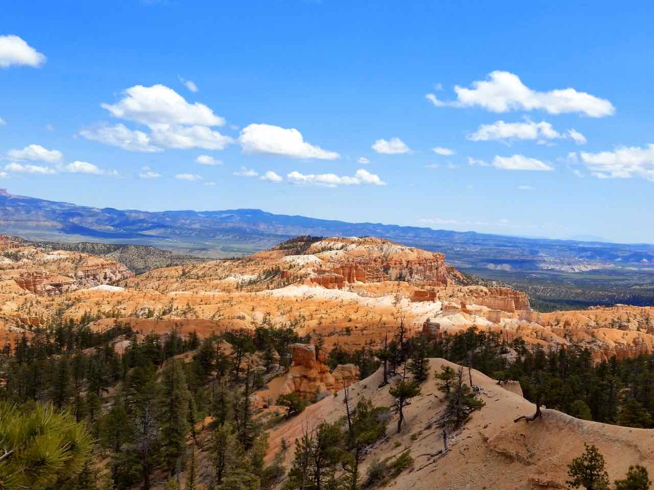
An overlook of the Bryce Amphitheater
The amphitheater looked so surreal and reminded me of a painting. I then remembered a passage I read in a National Park guidebook about how artists, when this place was first becoming popular, tried to captured the beauty of this area in paintings to show to people on the east coast. However, it was so extraordinary and different from the east coast that people thought the artists made it up. Who can blame them? Even standing there, the area didn’t seem completely real.
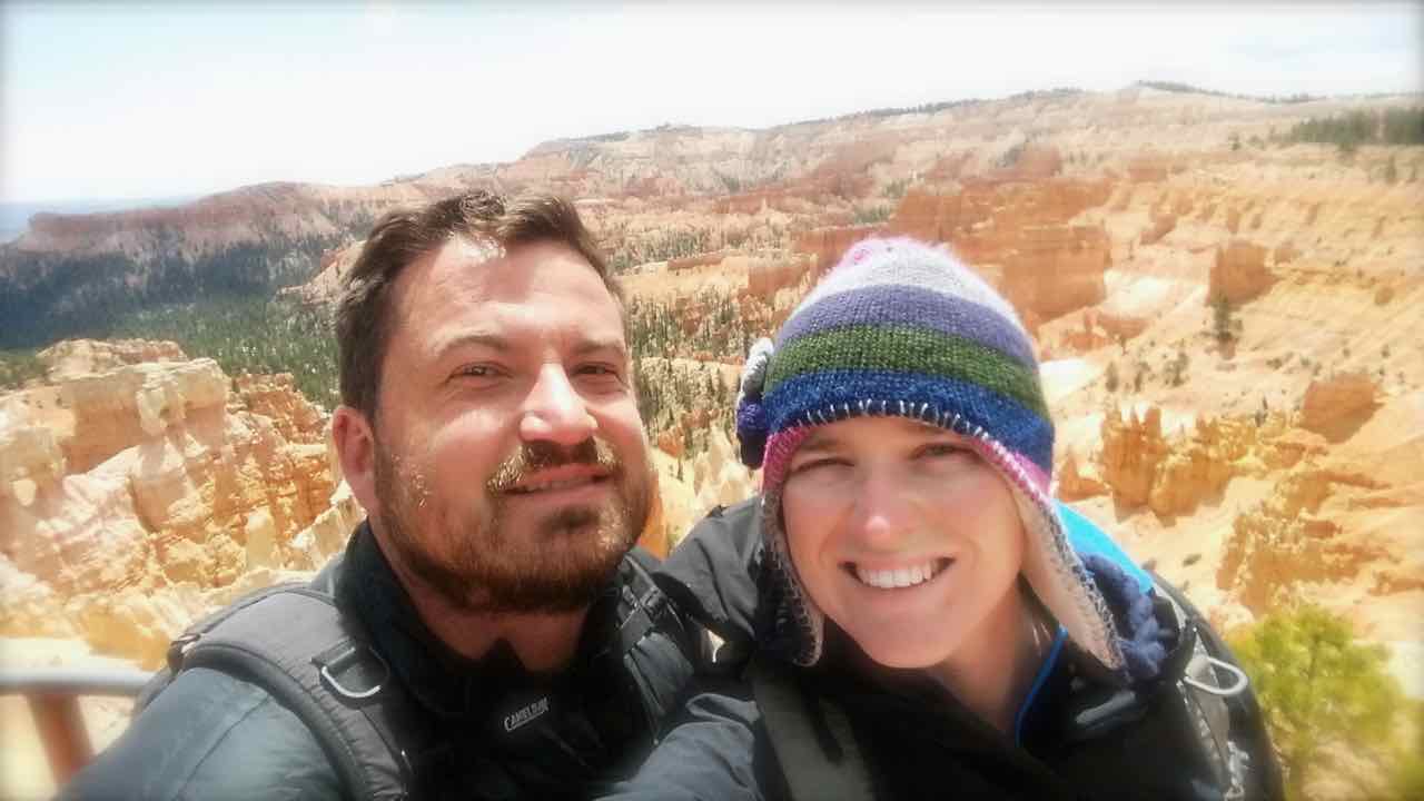
Bryce Canyon Selfie
The temperature difference between the top and bottom was noticeable. There was a cold wind blowing when we stood on top of the rim and the temperature was somewhere in the low 40s (Fahrenheit). By the time we made it down into the amphitheater, there was little to no wind and the temperature at the bottom was in the low 70s (Fahrenheit).

Less winder clothing at the bottom of the amphitheater due to the higher temperatures
KC and I did a loop hike, starting with the Queen’s Garden trail, then hopping on to the Navajo Loop trail, heading towards Wall Street. The trail past Wall street was closed for trail maintenance, so we went the other way on the Navajo Loop trail to Sunset Point. From Sunset point, we returned to Sunrise Point via the Rim Trail.

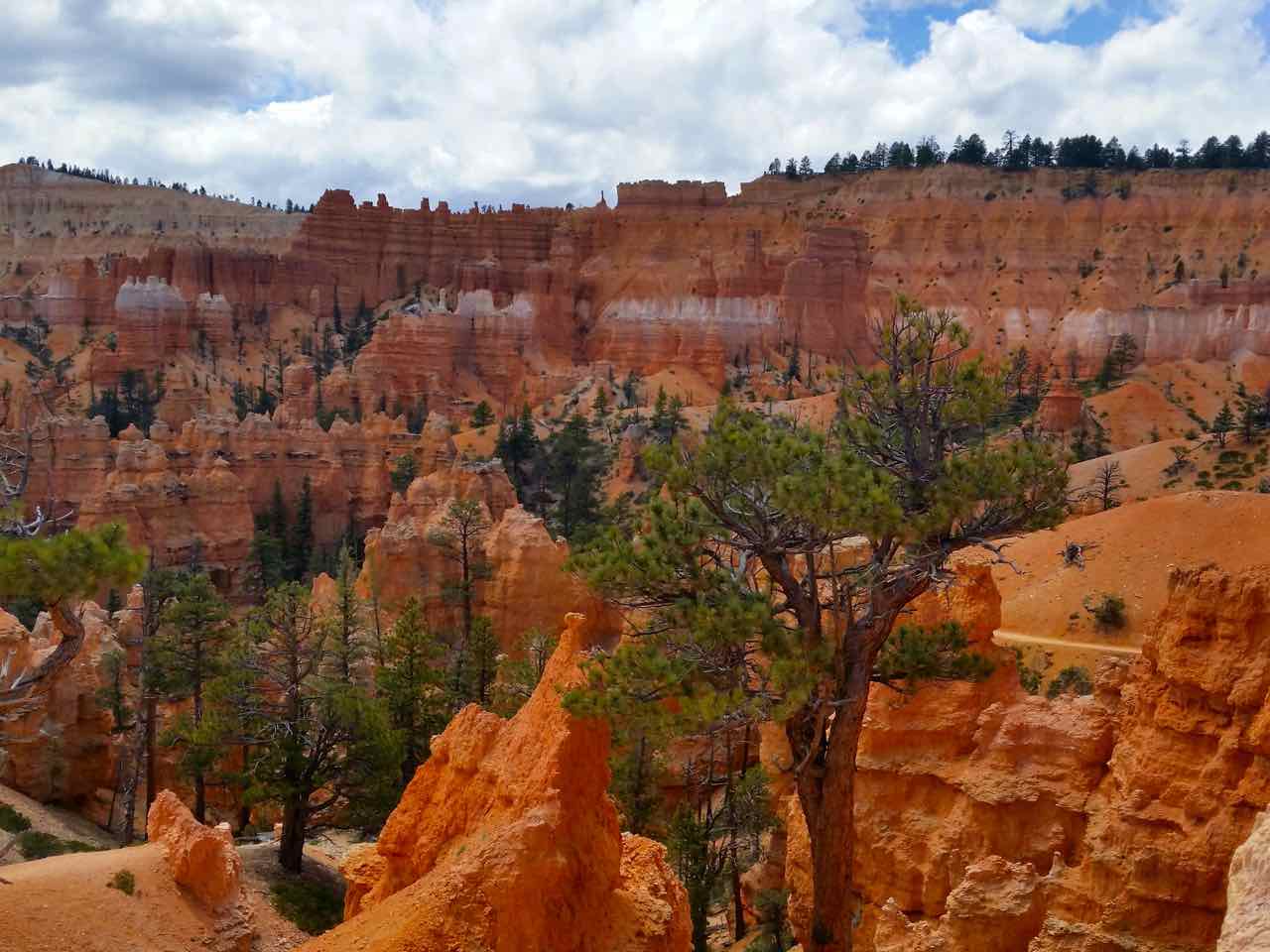
Hoodoos and sky
Along the trail we saw lots of hoodoos, which are rock formations caused by erosion in a “badlands” type area. These pinnacles that reach up to the sky will eventually be washed away by the same force that created them – erosion.
The trails were easy and fun to follow, with a workout at the end to gain the 600ft or so back to the top of the canyon rim. The pictures below follow our path around the amphitheater.

A closer view of the Bryce Canyon Amphitheater along the Queen’s Garden Trail
A view along the Queens Garden Trail

Hoodoos and sky along the Navajo Trail Look at Bryce Canyon
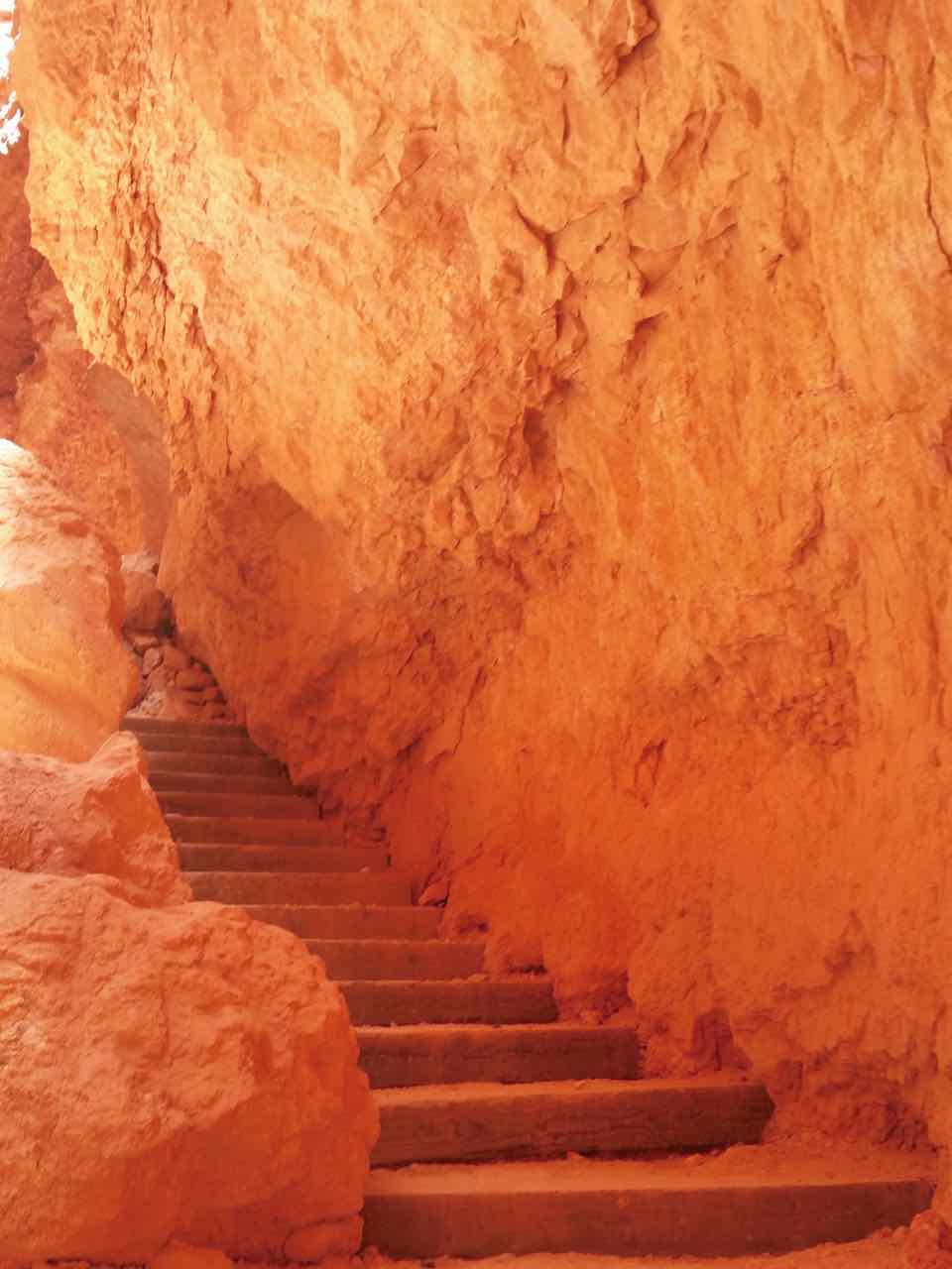
The rock formation called “Wall Street” along the Navajo Loop Trail
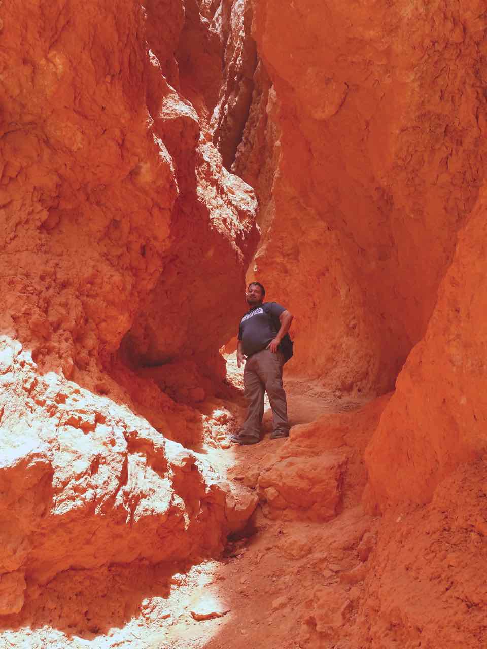
KC posing along the trail; he such a poser ;)
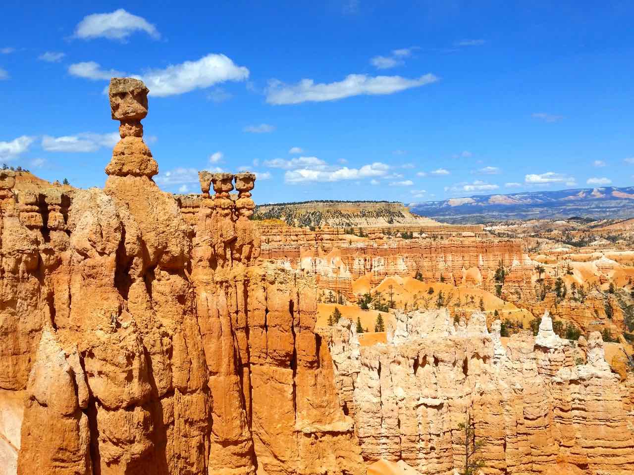
To the left of the picture is the hoodoo known as Thor’s Hammer

From the Rim Trail
The hoodoos towered above us and left us with a sense of awe. We didn’t shake the feeling that we were walking around in a painting while down in the amphitheater. This park is a natural work of art.
You can check out more pictures from our trip on our Utah Adventures Part 2 Photo Journal page.
More Information
Check out the National Park Internet site for more information about this national park.
